We’re cool for the summer … temporarily, at least
National Weather Service Spokane forecasts smokey conditions to clear, normal temperatures to return Thursday for next few weeks
Normal temperatures around mid to high 70s will return by the end of the week.
August 18, 2021
The worst appears to be over for the Pullman area this summer. High temperatures and hazy conditions will be replaced by cooler weather in the coming days, followed by a return to more average temperatures.
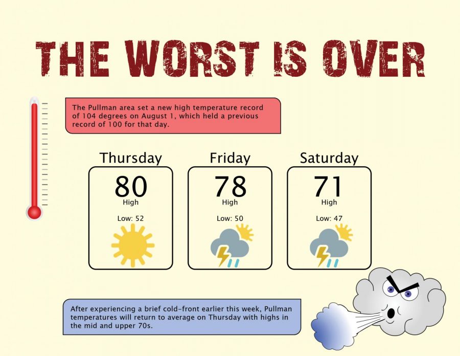
After experiencing a brief cold-front earlier this week, Pullman temperatures will return to average on Thursday with highs in the mid and upper 70s. Similar conditions are expected to continue into the next couple weeks.
The dense haze that hung over the Pullman area recently has finally cleared. The smoke, which was caused by nearby wildfires, remained immobile over the area due to high atmospheric pressure.
High pressure can act like a lid, trapping air in a region, said Steven Van Horn, meteorologist with the National Weather Service Spokane. A combination of light winds and poor air can cause smoke to get trapped in one area for a long period of time.
“High pressure is just a large-scale sinking motion, which is keeping the air at the surface near the surface,” Van Horn said.
This is especially common in a region like Pullman, which is located in a large basin surrounded by mountains.
As fires continue to burn throughout the summer, more haze is likely to occur. But it is unlikely that it will be as widespread across the Northwest as it has been recently, he said.
Another high-pressure system is not expected to build again in Pullman, so smoke will clear out of town more quickly, he said.
However, hazy conditions will continue to be present around communities near large fires, like those up in Northern Idaho. These areas have been receiving air quality alerts from the National Weather Service more frequently than areas in the Palouse.
More information about air quality in the region can be found on AirNow, which is a national air quality tracker.
“Not only do we have a lot of local fires here, but there’s a lot of fires up in British Columbia … so that smoke could be coming down to us as well,” Van Horn said.
The increase in fires is linked to the hotter and drier summers that Pullman and the Northwest as a whole have been experiencing recently.
This summer has been notably hot, Van Horn said. The Pullman area set a new high-temperature record of 104 degrees on Aug. 1, which held a previous record of 100 for that day.
Earlier on June 29, temperatures were as high as 106 degrees, which was the second-highest recorded temperature in Pullman since Aug. 4, 1961, when it hit 110.
“[These hot] conditions lead to fuels being more susceptible to burning,” Van Horn said. “Any time you get an ignition source, which usually is lighting, then there is a better chance of having fires. The wild card is how much lightning we get.”
Recent wildfires in the area have been caused by dry lightning storms striking easily burnable areas. Lighting is a common wildfire starter during summer months. More information about ongoing wildfires can be found on InciWeb, which is a national fire tracker.


